Selecting Features
The Parcel Viewer provides many layers to view. In addition to viewing the physical boundary of features you can also view underlying attribute data by clicking on a feature.
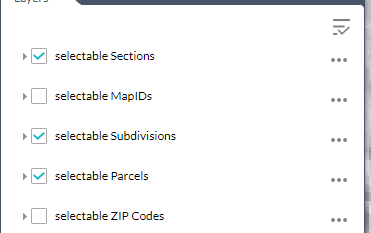
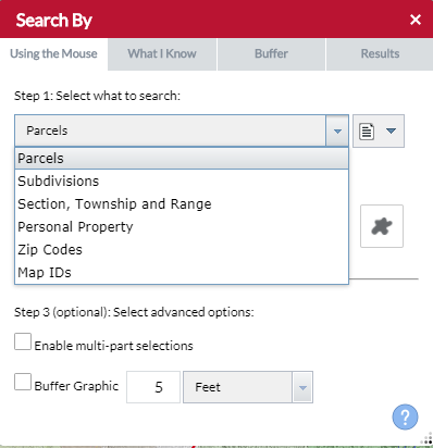
There are 5 selectable layers:
- MapIDs
- Subdivisions
- Parcels
- Sections
- Zip Codes
Checked Selectable Layers in the Layers tool are selectable. The parcel viewer is capable of selecting individual or multiple features.
How to Select Features
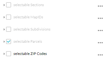
- From the Layers tool, expand the Selectable Layers. By default, only Parcels are selectable.
- Check the layers you want to be selectable and uncheck the one you don’t want to be selectable.
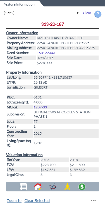
- Click on a feature to view its information. If the Feature Information panel is on it will be populated with data from the feature you clicked. If the Feature Information panel is off a popup will appear in the map and be populated with data from the feature you clicked.
- When multiple features are selected click the arrows in the top right to toggle between selected features.
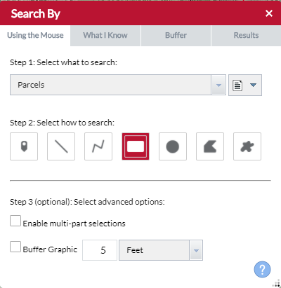
Use the Search By Tool to Select Features Using the Mouse
There are 6 shape search options available:
- Point
- Line
- Polyline
- Extent
- Circle
- Polygon
- Freehand Polygon

- Determine search action
- Create new results (default option)
- Add to current results
- Remove from current results
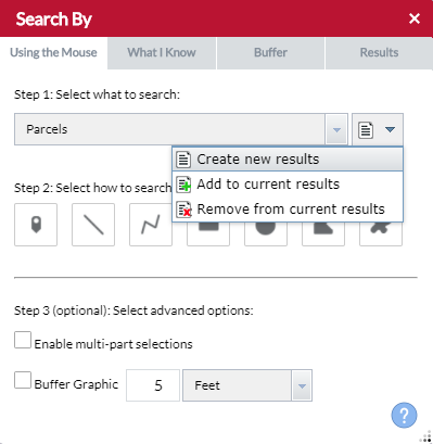
- Select a Search Layer.
- Select which shape type you want to Select features by
- To buffer a shape check Buffer Grapic and enter a search distance.
- The request will be processed when a shape is placed.
- When Enable multi-part selections is checked place multiple shapes then click Search for the request to be processed
- Results will appear in the map and Search Tool results tab.