Feature Information Panel
The Feature Information Panel allows you to:
- view attribute data of features in the map
- link to more data for features in the map
- view a quick Getting Started
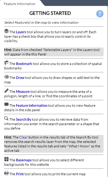
Getting Started
By default the Feature Information panel contains GETTING STARTED instructions to help understand the tools available in the map.
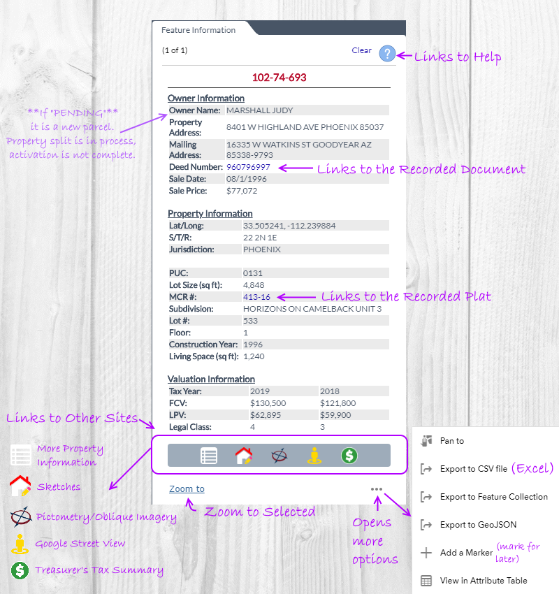
View Feature Attribute Data
- Once a feature is selected, the associated data will appear in the Feature Information Panel. (To learn how to select a feature, go to View Feature Information by.. below, or visit How To Select Features.)
- A visual overview of the information on the Feature Information Panel:
View Feature Information by Clicking a Feature
- When clicking in the map the Feature Information Panel will populate a layers features when a layer is selectable.
- For a layer to be selectable it must be checked in the Selectable Layers of the Layers tool.
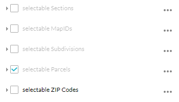
- All layers that are selectable will have their features added to the Feature Information panel. (Example: subdivision and parcel information can be sent to the panel on a single click)
- Holding CTRL and clicking allows you to keep adding features to the panel.
- The directional arrows allow you to view either the previous or next feature.

- When multiple features are selected only the feature that is currently visible in the Feature Information panel is highlighted in the map.
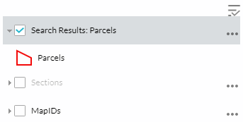
View Feature Information by Clicking a Search By Tool Result
- When a search is completed using the Search By tool the Results tab will list each result. Clicking a result will zoom to the feature and populate the Feature Information panel. Information is available for all search layers (Parcels, Subdivisions, MapIDs, Personal Property, Sections and Zip Codes).
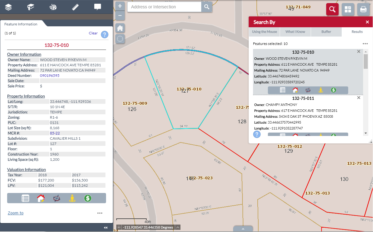
- The Search By tool also adds a result layer to the map. Clicking on the result layer will also send that information to the Feature Information panel.
- Holding CTRL and clicking allows you to keep adding features to the panel.
- The directional arrows allow you to view either the previous or next feature.