Draw
If you need to mark areas on the map the Draw tool allows you to create your own basic graphics and text on the Parcel Viewer map. It also can display measurements for drawn features such as area for polygons and length for lines.
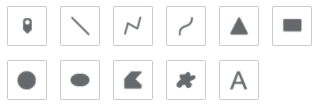
There are 11 drawing modes available (from left to right):
- Point
- Line
- Polyline
- Freehand Line
- Triangle
- Rectangle
- Circle
- Ellipse
- Polygon
- Freehand Polygon
- Text
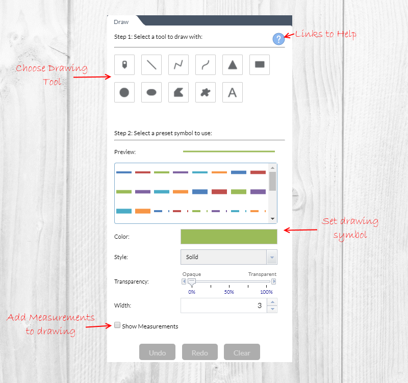
Visual Explanation of the Draw Tool
How to Use the Draw Tool
- Click the symbol type for the desired drawing mode.
- Optional: Change the symbol using the symbol picker.
-
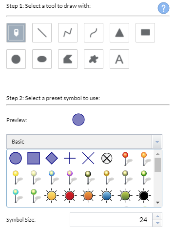
For point symbols:
Select the marker category (Basic is shown in this example) and symbol options desired (symbol options are different in each marker category).
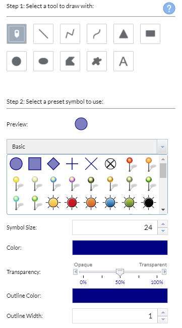
The point symbol size is adjustable.
-
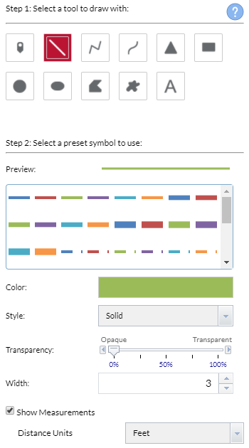
For line symbols:
Select the line style and options desired. Checking Show Measurements will display line measurements in the Distance Units you have selected.
-
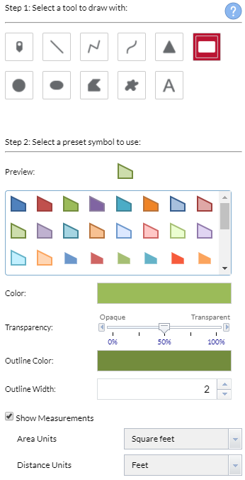
For polygon symbols:
Select the polygon style and options desired. Checking Show Measurements will display polygons and their respective Area Units and Distance Units you chose.
-
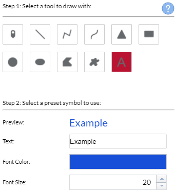
For text symbols:
Enter the text to be drawn and options desired.
- Draw text and/or desired features on the map.
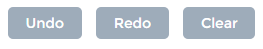
- To remove all Draw features from the map, click Clear.
- To undo an action, such as clear, click Undo.
- To redo an action, click Redo.