Buffer
Several methods are available for you to spatially select features.
Buffer by User Defined Shapes
**This will only buffer the graphic drawn, not what is selected by the graphic.
**This will only buffer the graphic drawn, not what is selected by the graphic.
- In the Search By tool navigate to the Using the Mouse tab
- Determine search action
- Create new results (default option)
- Add to current results
- Remove from current results
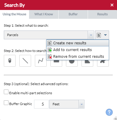
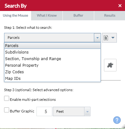
- Select a Search Layer.
- Select which shape type you want to Select features by.
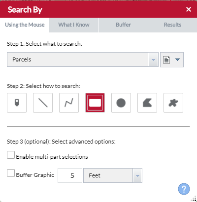
- Determine if you need to buffer multiple user defined shapes and check Enable multi-part selections accordingly.
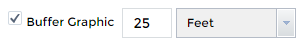
- Check Buffer Graphic and enter a search distance.
- Place your shape in the map.
- When Enable multi-part selections is checked place multiple shapes then click Search for the request to be processed.
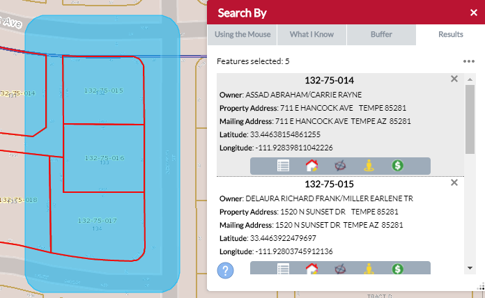
Buffer Search By tool results (example: use a subdivision boundary to select the parcels inside it’s boundary)
- In the Search By tool, use either the Using the Mouse or What I Know search options to populate the Results tab.
- Once the Results tab is populated, switch to the Buffer Something tab.
- Enter a search distance and unit of measurement then click Apply Buffer. This will add a buffer to the map (the blue fill).
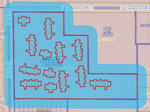
- To select parcels within the Buffer click either the Entirely within the Buffer or Within or touching the Buffer buttons. (If you applied a buffer in the previous step choose buffer, else choose Selection)
Example of Entirely within the Buffer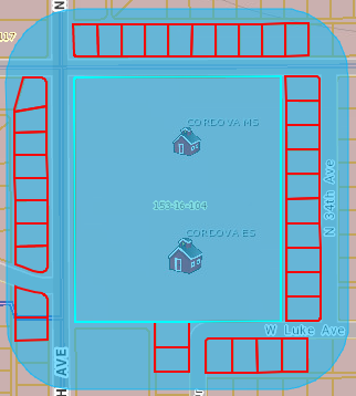
Example of Within or touching the Buffer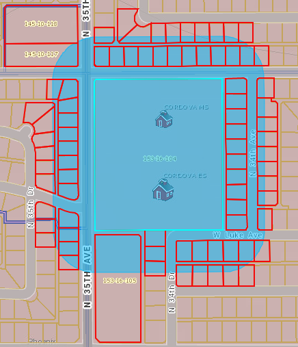
- Results will appear in the map and Search By Results tab.
- To clear your buffer click Clear Buffer.